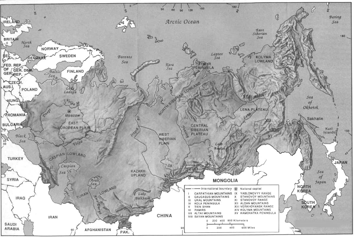
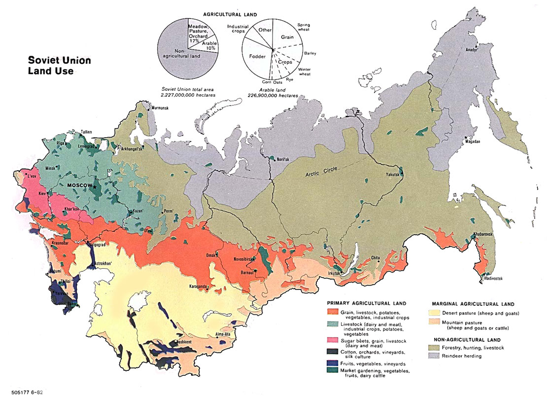
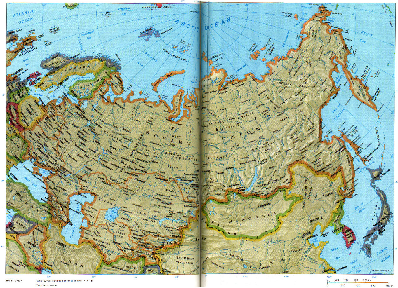
Maps of the Soviet Union
1918-1920: Maps depicting army locations and movements in Soviet Russia during the Civil Wars of 1918-1920.
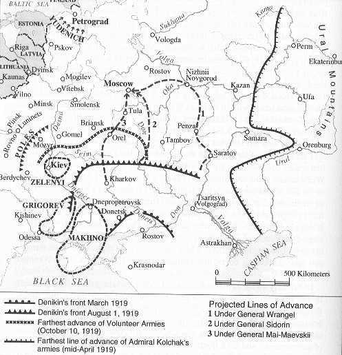
The farthest reaches of Wrangel, Denikin, and Kolchaks front lines, 1919
1979: English language-maps made by the Central Intelligence Agency of the United States of America.
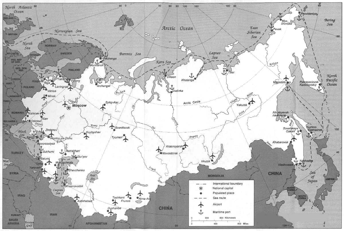
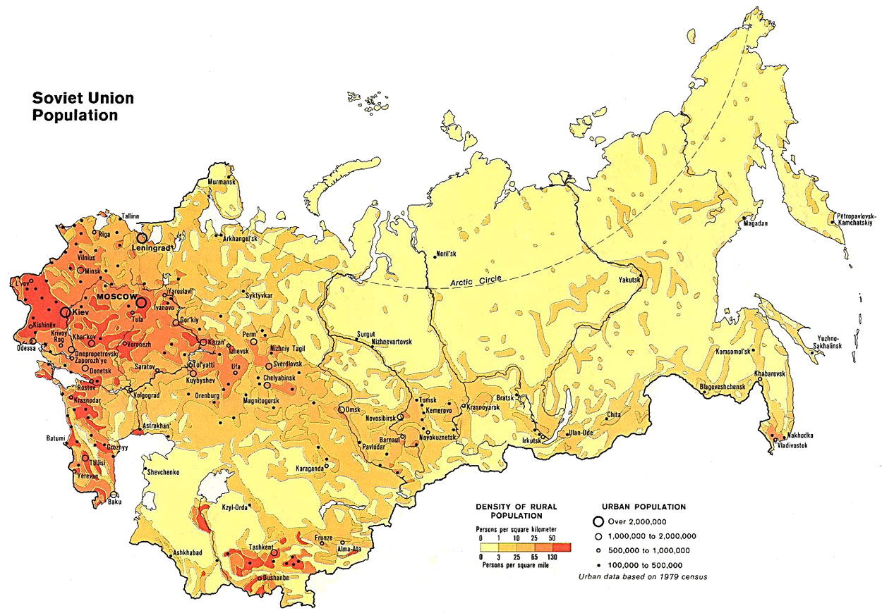
1982: Also made by the C.I.A., using 1979 Soviet census data.
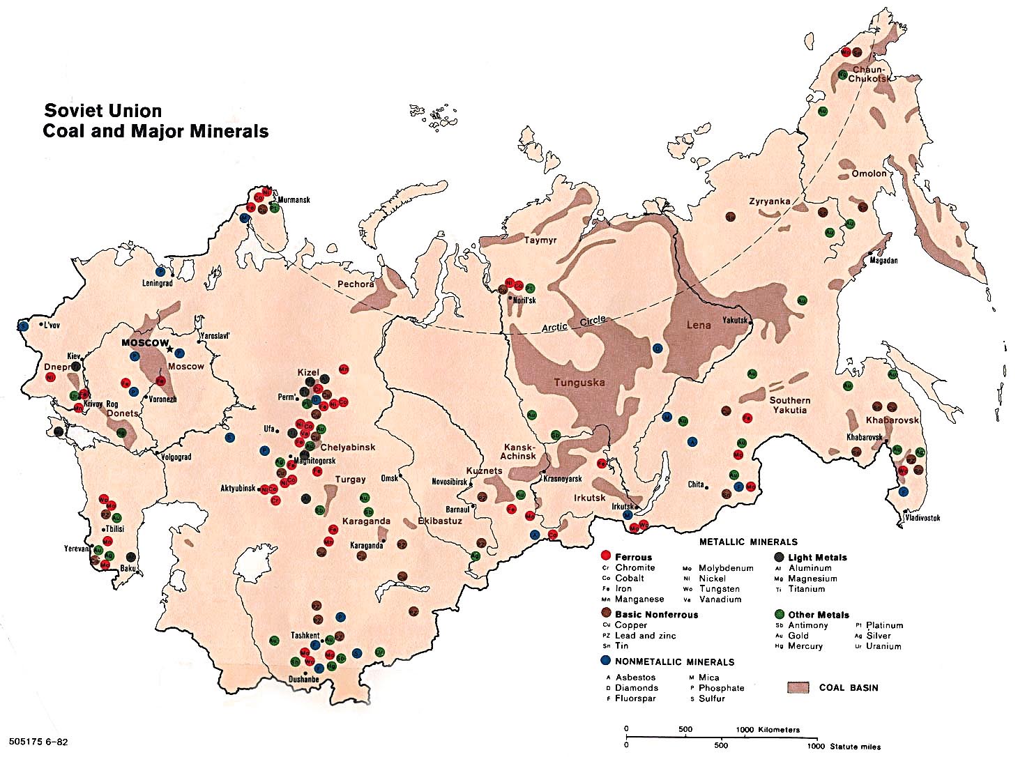
Coal and major mineral deposits (from Aluminum to Uranium)
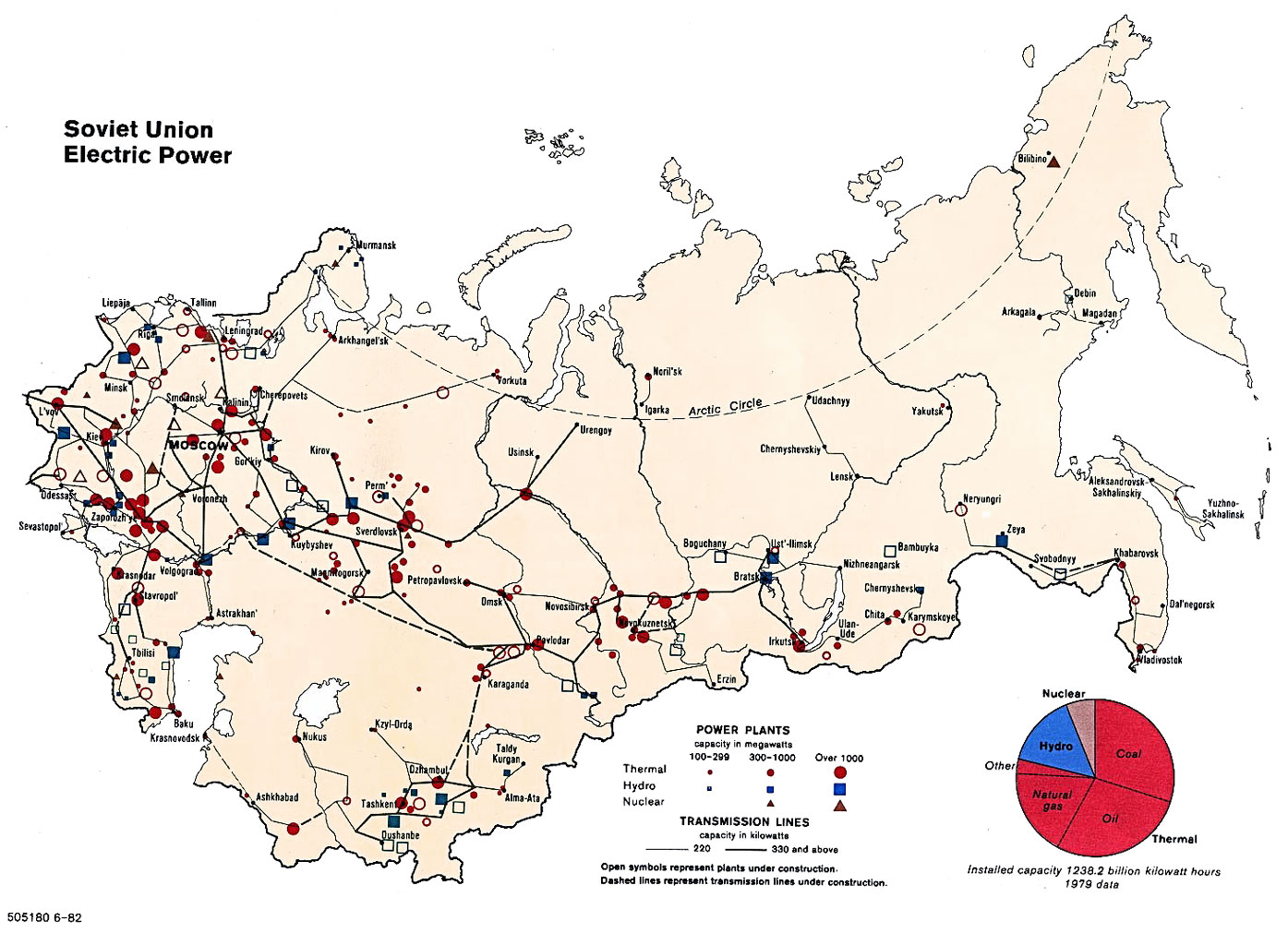
Electric Power plants (Thermal/Hydro/Nuclear)
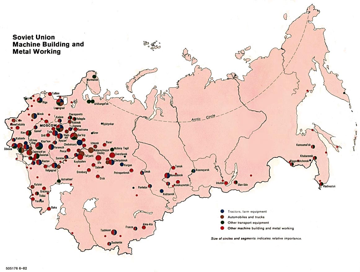
Machine Building and Metal Working plants
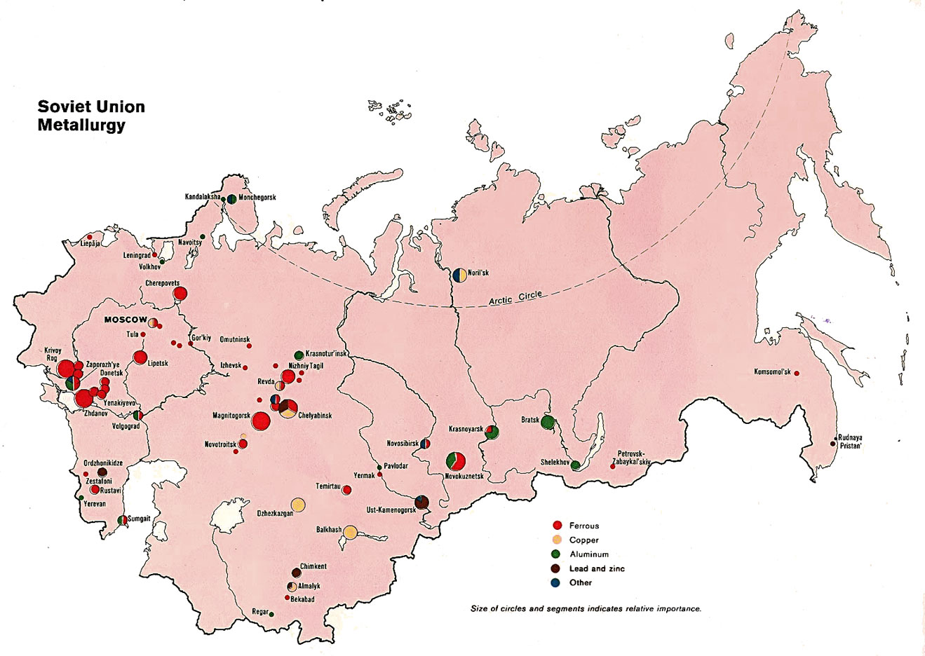
Metallurgy (Ferrous, Copper, Aliminum, Lead/Zinc)
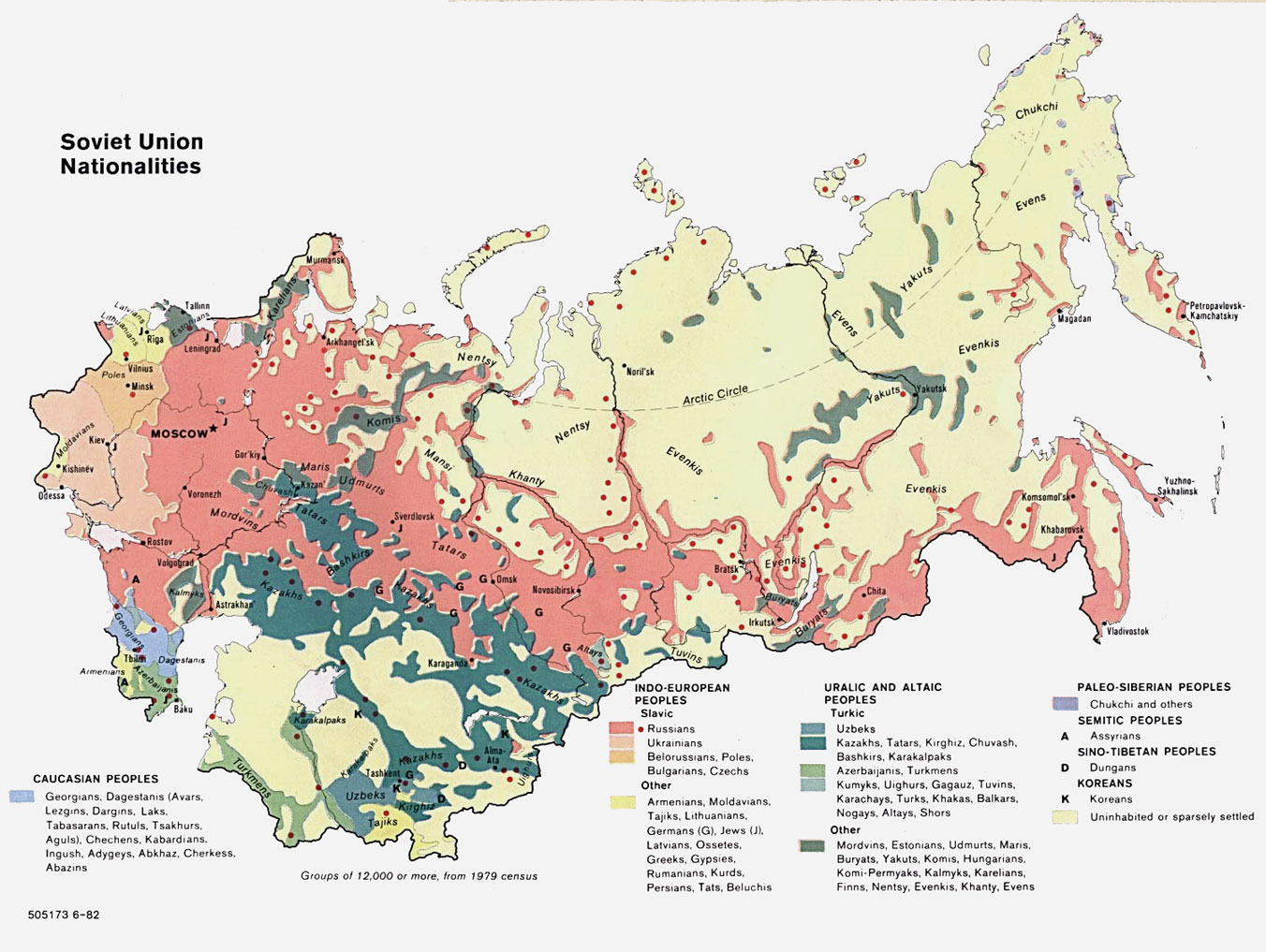
Nationalities (over 60 nationalities, represented by 13 color groupings)
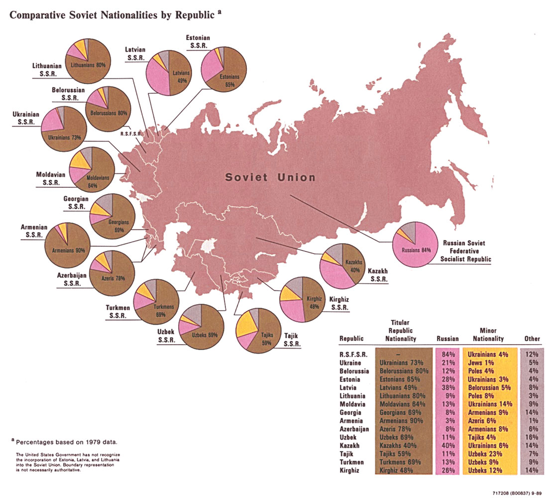
Nationalities: Comparative by Republic
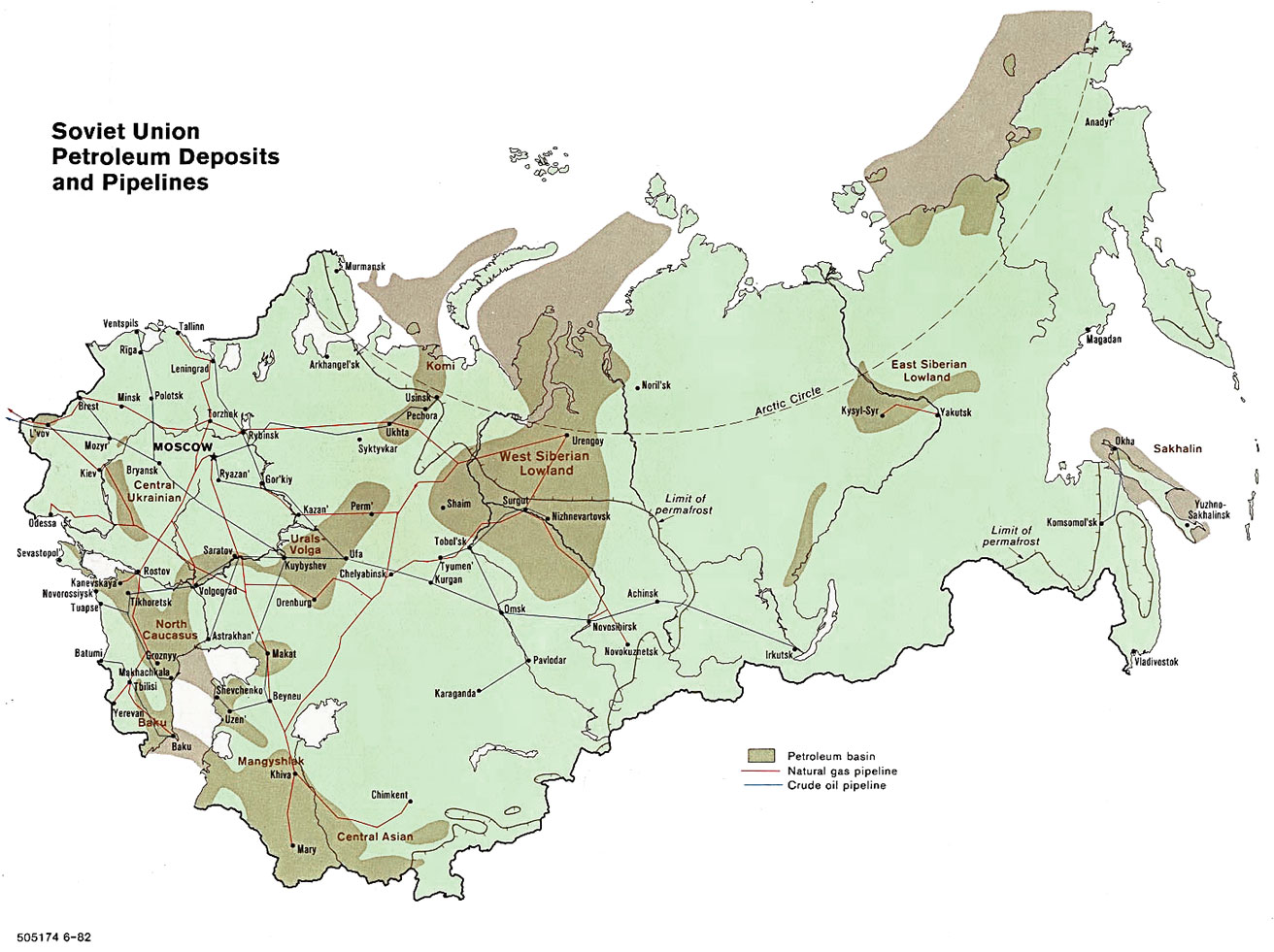
Petroleum Deposits and Pipelines (Crude oil and Natural gas)
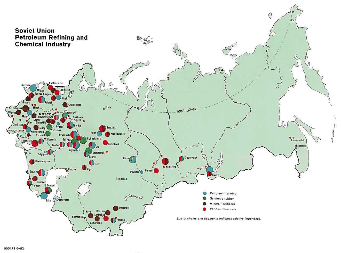
Petroleum Refining and Chemical Industry
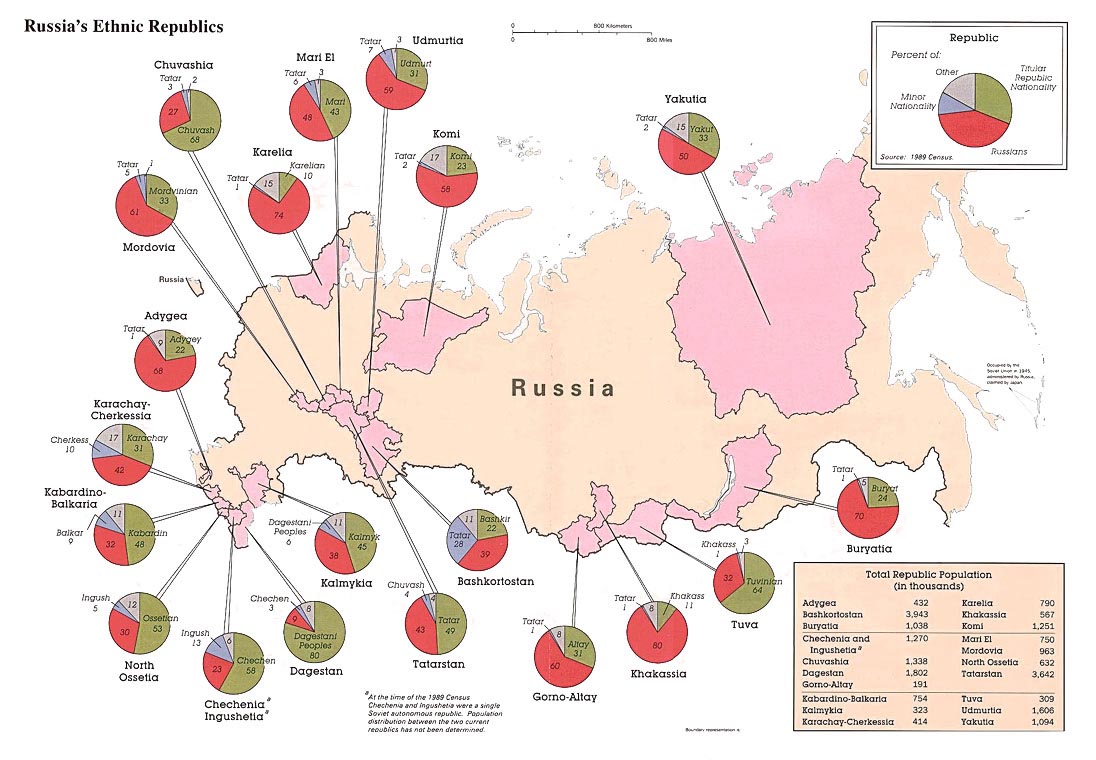
1989: National minorities of Russia
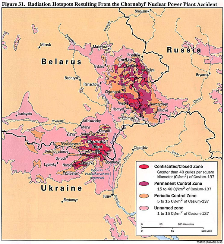
1996: Radiation Hotspots in Chornobyl